I wrote before about Thomas Milne’s Map of Hampshire of 1791, noting both the errors it contained and the familiar roads which were already there and those which weren’t. This 1 inch OS map has corrected most of the errors and shows more detail. It must have been last surveyed after 1840 because it shows the railway line and station which opened in that year. However, it is otherwise more or less the same as the OS map of 1831.
The one error it has in common with the older map is that it still names everything Curbridge. The name Curdridge is still nowhere to be seen. As before, the centre of the village is the Common, with a small cluster of buildings on what is now Church Lane, although no church is marked, even though the original Chapel of Ease was constructed in 1835. Otherwise, there are farms and other clusters on the lanes beyond the Common.
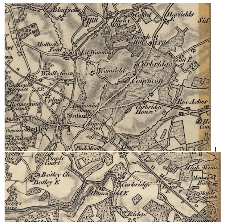
One cluster, to the South of the Common, is marked Curbridge House. This is where Kitnocks House now stands. Meanwhile, Curdridge House is nowadays a house on the Bishops Waltham road – probably marked by the single building to the North East of the churchless cluster. Does anyone know how or when the names changed ?
Most interestingly, there is a new road on the map – the Turnpike Road which runs from the top of the Common towards Harfield and beyond. This is the Bishops Waltham Road and provided a more direct route than having to go by Curdridge Lane via Waltham Chase. Also of note, a pond is marked on both sides of the road. This would have been used to provide drinking water for horses and to wash down both horses and carts. This, of course, is Cricketer’s Pond.
Reading Room Lane, Chapel Lane and the Southern end of Wangfield (Wamfield on the map) are yet to be constructed. Fairthorn on the map is what is now Fairthorne Grange – Fairthorne Manor was not built until 1854. Outlands Lane splits into two across the Common, and the Eastern track is still evidenced by the line of houses set back from the modern Lane – as, for example, in the case of Kitnocks Farm house.
The memorial stone at the station is marked. This is the stone ‘Erected to Perpetuate a Most Cruel Murder Commited on the Body of Thomas Webb a Poor Inhabitant of Swanmore on the 11th of February 1800’ which I wrote about some time ago. (Search: Curdridge local history).
Kevan Bundell